 vesseltracker.com
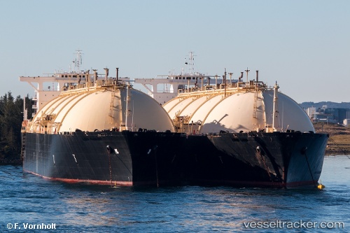
Vessel BERING ENERGY IMO: 7390155, MMSI: 538007445 LNG Tanker
Live AIS position:
UTC. 123 nm S of Minachi),
updated 2025-08-19 10:36:42 UTC.
Find the position of the vessel BERING ENERGY on the map. The latter are known coordinates and path.
marine traffic ship tracker show on live map
The current position of vessel BERING ENERGY is 31.82430 lat / 136.34273 lng. Updated: 2025-08-19 10:36:42 UTCCurrently sailing under the flag of Marshall Islands
BERING ENERGY built in 1978 year
Deadweight:
72555 tDetails:
Last coordinates of the vessel:
2025-08-19 10:36:42 UTC, 31.82430, 136.34273, course: 106, speed: 25.6